Property Record
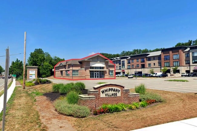
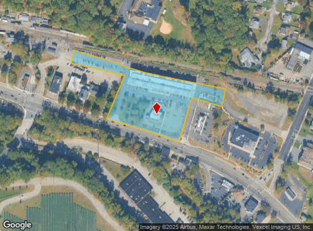
480 State Route 10, Whippany, NJ 07981
Current Lease Availabilities
NEARBY LISTINGS FOR SALE OR LEASE
Property Detail
480 State Route 10
Northern New Jersey
Whippany Village Condo
Newark, NJ-PA
ADDITIONAL LOTS: COMMON 4.5% 7402,8
12-07501-0000-00010-0000-C0002
Morris
Storemultistory
New Jersey
2024
10
2025
0.98 AC
045603
Parsippany
1,248 SF
DEMOGRAPHICS near 480 State Route 10
1 Mile
3 Mile
5 Mile
2024 Total Population
4,550
40,539
168,723
2029 Population
4,569
40,568
168,623
Pop Growth 2024-2029
+ 0.42%
+ 0.07%
(0.06%)
Average Age
45
44
42
2024 Total Households
1,712
14,875
63,641
HH Growth 2024-2029
+ 0.35%
+ 0.05%
(0.01%)
Median Household Inc
$141,964
$136,030
$126,837
Avg Household Size
2.60
2.70
2.50
2024 Avg HH Vehicles
2.00
2.00
2.00
Median Home Value
$659,220
$624,749
$635,346
Median Year Built
1969
1973
1968
Nearby Places
- Restaurants
- Banks
- Shops
- Fitness
- Groceries
PUBLIC TRANSPORTATION
COMMUTER RAIL
Morristown (Morris & Essex Morristown Line - NJ Transit Commuter Rail (NJ Transit))
DRIVE
WALK
Distance
Morristown (Morris & Essex Morristown Line - NJ Transit Commuter Rail (NJ Transit))
9 min
4.5 mi
Morris Plains (Morris & Essex Morristown Line - NJ Transit Commuter Rail (NJ Transit))
DRIVE
WALK
Distance
Morris Plains (Morris & Essex Morristown Line - NJ Transit Commuter Rail (NJ Transit))
9 min
4.9 mi
AIRPORT
Newark Liberty International
DRIVE
WALK
Distance
Newark Liberty International
30 min
22.9 mi
LaGuardia
DRIVE
WALK
Distance
LaGuardia
58 min
41.9 mi
Freight Ports
Maher Terminal
DRIVE
WALK
Distance
Maher Terminal
34 min
23.5 mi
Nearby Properties
Address
Land Use
TOTAL SIZE
Lot Size
Zoning
Address
Land Use
TOTAL SIZE
Lot Size
Zoning
701 SF
111.59 AC
SED
Address
Land Use
TOTAL SIZE
Lot Size
Zoning
48.76 AC
OBRL
Address
Land Use
TOTAL SIZE
Lot Size
Zoning
596 SF
64.81 AC
OBRL
Address
Land Use
TOTAL SIZE
Lot Size
Zoning
64.80 AC
C-4
Address
Land Use
TOTAL SIZE
Lot Size
Zoning
9.80 AC
Address
Land Use
TOTAL SIZE
Lot Size
Zoning
10.94 AC
Address
Land Use
TOTAL SIZE
Lot Size
Zoning
43.60 AC
C-4
Address
Land Use
TOTAL SIZE
Lot Size
Zoning
18.42 AC
RM
Address
Land Use
TOTAL SIZE
Lot Size
Zoning
577,851 SF
35.90 AC
SD5A
Address
Land Use
TOTAL SIZE
Lot Size
Zoning
13.10 AC
R-25
Address
Land Use
TOTAL SIZE
Lot Size
Zoning
11,353 SF
9.29 AC
COD
Address
Land Use
TOTAL SIZE
Lot Size
Zoning
10.42 AC
Address
Land Use
TOTAL SIZE
Lot Size
Zoning
46.46 AC
B-3
Address
Land Use
TOTAL SIZE
Lot Size
Zoning
3.86 AC
O-3
Address
Land Use
TOTAL SIZE
Lot Size
Zoning
58.20 AC
I
Address
Land Use
TOTAL SIZE
Lot Size
Zoning
11.80 AC
I/B
Address
Land Use
TOTAL SIZE
Lot Size
Zoning
13.45 AC
IP
Address
Land Use
TOTAL SIZE
Lot Size
Zoning
336,832 SF
46.12 AC
R-L
Address
Land Use
TOTAL SIZE
Lot Size
Zoning
6.64 AC
Address
Land Use
TOTAL SIZE
Lot Size
Zoning
25.14 AC
I-B3
Address
Land Use
TOTAL SIZE
Lot Size
Zoning
201,648 SF
19.35 AC
B-1
Address
Land Use
TOTAL SIZE
Lot Size
Zoning
18.29 AC
C-1
Address
Land Use
TOTAL SIZE
Lot Size
Zoning
23.15 AC
SD10
Address
Land Use
TOTAL SIZE
Lot Size
Zoning
220,440 SF
20 AC
OL15
Address
Land Use
TOTAL SIZE
Lot Size
Zoning
49.53 AC
P
Address
Land Use
TOTAL SIZE
Lot Size
Zoning
25.40 AC
I-3
Address
Land Use
TOTAL SIZE
Lot Size
Zoning
28.84 AC
OBDS
Address
Land Use
TOTAL SIZE
Lot Size
Zoning
5.35 AC
MF-6
Address
Land Use
TOTAL SIZE
Lot Size
Zoning
16.72 AC
C-3
Address
Land Use
TOTAL SIZE
Lot Size
Zoning
333,991 SF
15.76 AC
SD10
The World's #1 Commercial Real Estate Marketplace
Connect with us
© 2025 CoStar Group
The information above has been obtained from sources believed reliable. While we do not doubt its accuracy we have not verified it and make no guarantee, warranty or representation about it. It is your responsibility to independently confirm its accuracy and completeness. Any projections, opinions, assumptions, or estimates used are for example only and do not represent the current or future performance of the property. The value of this transaction to you depends on tax and other factors which should be evaluated by your tax, financial, and legal advisors. You and your advisors should conduct a careful, independent investigation of the property to determine to your satisfaction the suitability of the property for your needs.